


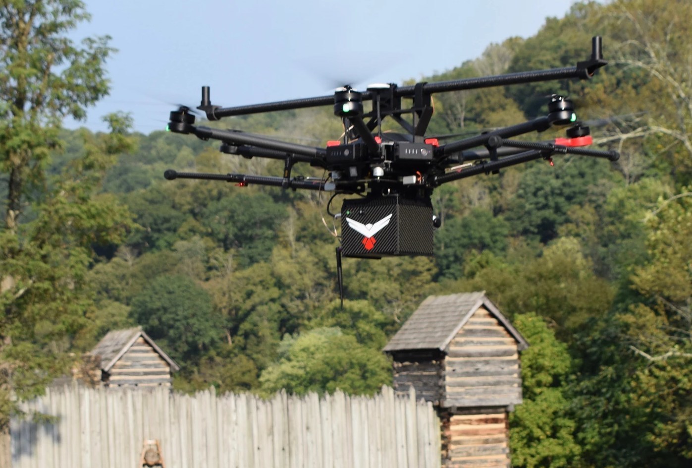
FAIRMONT, W.Va., Oct. 23, 2019 /PRNewswire/ -- RedTail LiDAR Systems – a division of 4D Tech Solutions, Inc. – is pleased to introduce the RTL-400 LiDAR mapping system at the Commercial UAV EXPO on October 28th. The RTL-400 was designed specifically to provide high-resolution 3D images of objects on the ground from small drones flying at an altitude up to 400 feet.
Developed with technology licensed from the U.S. Army Research Laboratory (ARL), the RTL-400 provides unique scanning capabilities for a wide range of applications – from precision agriculture to construction site monitoring and management.
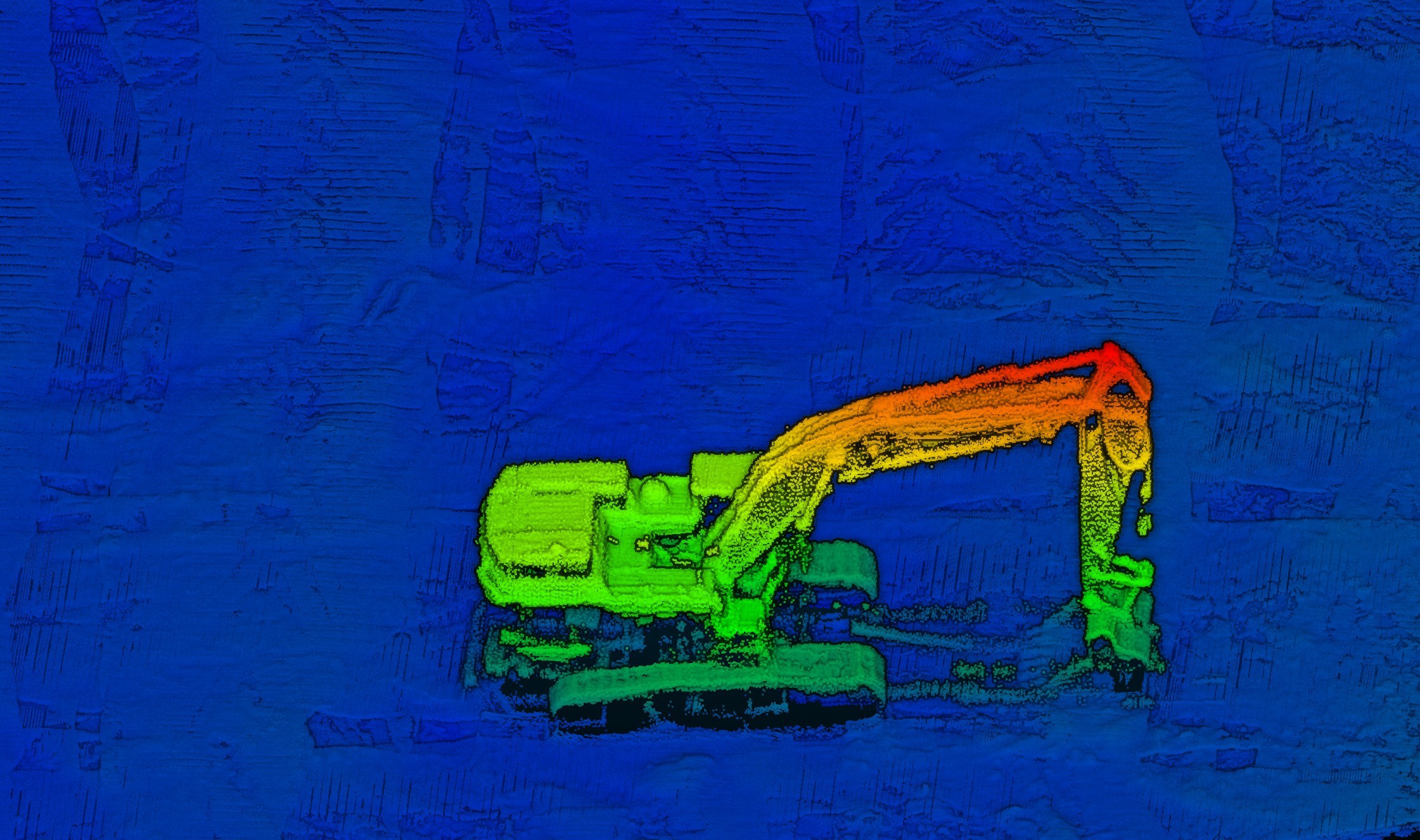
The RTL-400 incorporates an innovative microelectromechanical system (MEMS) mirror-based laser scanner that rapidly and evenly distributes laser pulses to the ground, moving side-to-side 400 times each second. This rapid line scan rate, coupled with a laser pulse rate of up to 400,000 pulses per second, yields point clouds that are unprecedented in resolution and density.
Unlike other LiDAR systems, the RTL-400 can be operated in two scanning modes. In addition to the line scan mode, the RTL-400 offers a 30 x 30-degree raster scan mode for "stand and stare" missions. The scanning mode can be selected on the fly, providing drone operators unmatched operational flexibility when planning and flying their missions.
"We are very excited to introduce RedTail LiDAR System's RTL-400. This product has been optimized for use on small drones, providing high-quality point clouds to meet the needs found in the numerous fields where LiDAR is used," said Brad DeRoos, President and CEO of RedTail LiDAR Systems.
Meet the RedTail LiDAR Systems team at the Commercial UAV EXPO in Las Vegas, October 28-30, booth # 635. Learn more about the RTL-400 at the Group Pitch at 1:15 p.m. on October 29th in the Exhibit Hall Theater.
Learn more at https://www.redtaillidar.com/
About RedTail LiDAR Systems
RedTail LiDAR Systems is a division of 4D Tech Solutions, Inc., a company focused on providing innovative technology-based solutions to address government and commercial customer needs. RedTail LiDAR System's in-house technical expertise – coupled with a full suite of software and hardware design and manufacturing tools – allows us to develop custom LiDAR solutions for manned and unmanned vehicle applications. 4D Tech Solutions, Inc. is a Service-Disabled Veteran-Owned, HUBZone-certified small business.
For more information contact:
Bryson Begley, Marketing Manager, RedTail LiDAR Systems
227768@email4pr.com
(304) 306-2396
www.redtaillidar.com


SOURCE RedTail LiDAR Systems
